CONTACT DETAILS
Telephone: 0447 628 831
Email: info@airmap3d.com
OUR LOCATION
Airmap3D
PO Box 344
Moranbah QLD 4744
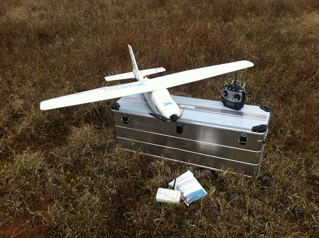
Airmap3D operates the MAVinci Sirius PRO Unmanned Aerial System as their primary platform for data capture.
The system consists of the UAV (unmanned aerial vehicle) which is a battery powered, 1.6m wingspan fixed wing aircraft constructed primarily from elapor. It has a TOW (take-off weight) of approximately 2.7kg.
It is capable of missions of up to 55min in duration in which it can cover up to 70+ hectares with a GSD (Ground Sample Distance) of 3.2cm. It can withstand winds of up to 50kmh, gusts up to 65kmh and even light to moderate rain.
It is controlled by on-board autopilot software developed by MAVinci and has the option of full auto, assisted auto and full manual control. This is one of many reasons it has the edge over other UAVs as the pilot has much more control over the system at all times, if and when needed. It is also one of only a few UAV’s worldwide with on-board RTK GPS, eliminating the need for ground control points and delivering extremely accurate data.
MAVinci Desktop is the software used for programming the flight paths. It has the capability of automatically calculating multiple flights to cover large areas in optimum time. The software also prepares the images and photo logs for processing in various other post-processing software packages.
Post processing is performed using very powerful workstations to handle the massive size of the datasets acquired.
Thousands of images can be captured in just one flight and these are processed using Agisofts ‘Photoscan Pro’ software. This is a very complex software package and is able to produce very accurate geo-referenced orthomosaic photographs and 3 dimensional models.
This output data is then ‘cleaned up’ further using a combination of several other CAD and Point Cloud processing software packages to produce the final output data desired by our clients.
Processing can be a time consuming part of UAV operations but Airmap3D’s powerful and portable workstations can have the data ready for delivery to the client within a few hours after the flight.
Output data can be tailored to suit your specific requirements. Almost every common format used in GIS, Engineering and Surveying software can be produced. We will have a format available to suit your needs.
Data analysis and reporting is also a main function of our business. Various reports and plans can be produced to suit our clients needs. Volume reporting, contour plans and feature plans are just some of our common requests.

